How Habistack helps make road trips safer and easier
October 7, 2022 by Rich kurtzman, Brand Communications @ Fathym

In this piece:
- Introduction to Habistack API
- Using Habistack and Proadject together to plan a road trip from Denver to Steamboat Springs, CO
- Illustrating how Proadject and Habistack help plan safer travel
In this modern age, most people live in urban areas.
In fact, it’s nearly 83% do per this.
With most of us living in the urban jungle – being burdened by noise from cars, pollution and concrete everywhere – many folks are heading out of town on road trips for vacations.
And as we get on the road, exploring places we’ve never seen before, we need to know what the weather will be. That’s even more crucial when camping in the great outdoors.
Luckily, Habistack can help in planning a road trip and preparing people for not only the weather conditions when they get to their destination, but also all along the way.
Habistack introduction
Habistack is a robust, feature-rich API that offers a powerful suite of weather forecasting and open-source data visualization tools.
Habistack combines the world's best weather forecasts with statistics-based, machine-learning techniques to tackle the largest datasets, including road weather. Habistack offers developers comprehensive weather forecasting capabilities over freely chosen locations and routes across the globe. The API delivers a unique suite of highly specialized forecast variables derived through statistically based machine learning models.
It uses 15 data measurements and then evaluates them using artificial intelligence and machine learning.
Road Trips
In America’s “wild west,” there are a lot of wide open spaces to explore.
From the Grand Canyon in Arizona, to Arches National Park in Utah, to Yellowstone and Grand Teton National Parks in Wyoming and Rocky Mountain National Park in Colorado, just to name a few.
Wouldn’t it be nice to know what weather to expect on the road level while traversing treacherous mountain passes? And to know when and where there could be delays?
Now you can.
Habistack allows drivers to input their route and predict the weather along the entire way. That brilliant technology can be used on shorter drives, like the daily commute, as well as for longer, multi-day road trips.
Living in a place like Colorado – where Fathym is headquartered – a road trip within just the Centennial State can mean elevation changes of 5,000 feet, quickly changing weather, and camping at elevation where the temperature drops greatly at nightfall. Be prepared and get the most out of your road trips with Habistack.
Use case | Denver to Steamboat Springs
While there are some Colorado ski towns which get a ton of adoration – Vail and Aspen come to mind – Steamboat Springs is a gem.
There’s much more to do in Steamboat outside of skiing, though.
This time of year, going leaf peeping there can be fun, especially in late September. In the summer, Steamboat is a great place to go fly fishing in the Yampa River, to go fishing, or to stay in their downtown area with the family.
The drive from Denver to Steamboat – in the northwestern part of Colorado – is about 3 hours, depending on many factors. Time of day and traffic will slow you down, and so will traffic while driving from one side to the other of the Great Divide. And then again, as you climb up and over Rabbit Ears Pass, the weather can be wet, cold, icy and dangerous.

Rabbit Ears outside of Steamboat Springs, Colorado.
Using Habistack with Proadject
Habistack is open and free to the public to use. There are also pricing plans for developers that want to use Habistack APIs to forecast weather and road conditions in their own applications.
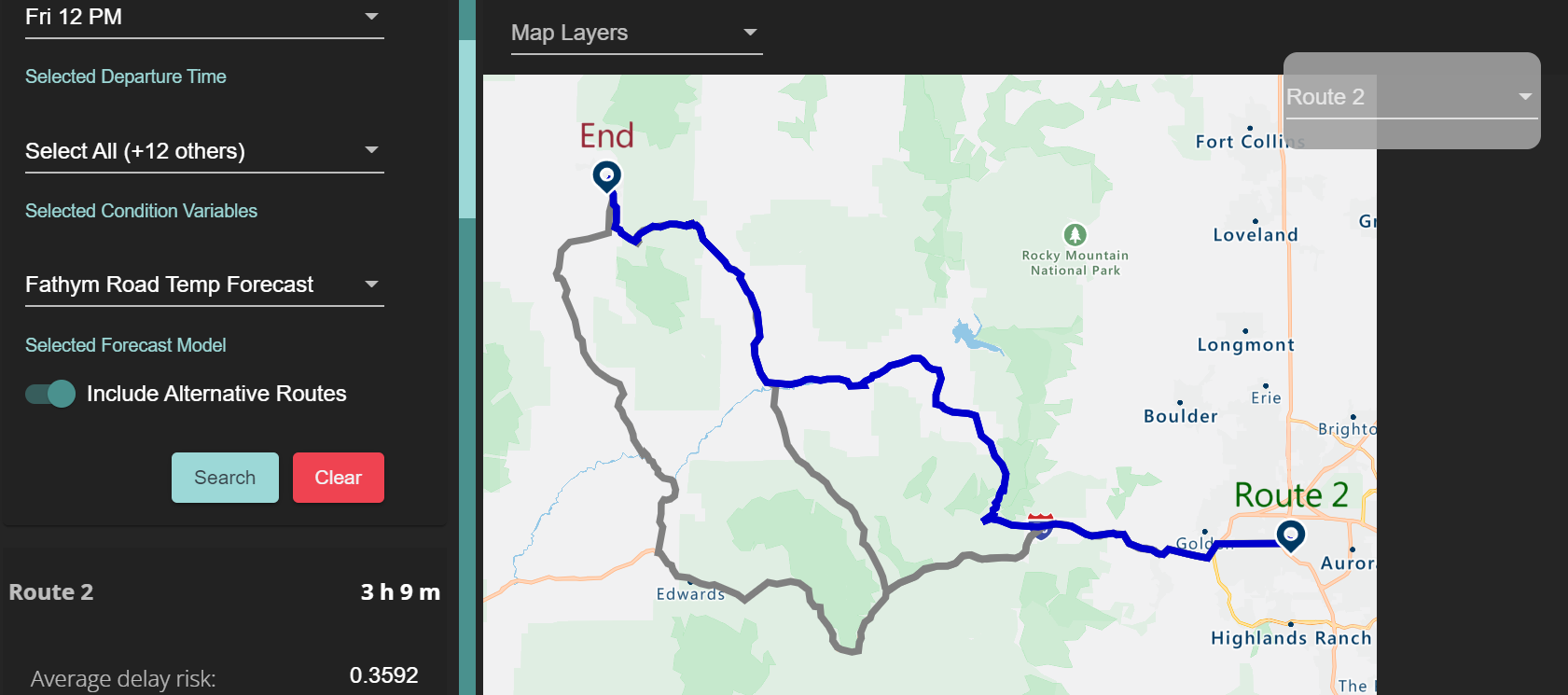
For our Denver to Steamboat example, you simply input the starting and ending points and let Proadject and Habistack work for you. Proadject is the web app Fathym built that allows you to enter your start/end points and it’s using Habistack’s Forecast APIs behind the scenes to get the different routes and road forecasts.
For this drive, the AI gives three possible routes as well as the time it takes to drive them and a ton of different predictions for weather along the way.
What's great is you can hover over different forecasts – like road state (wet or dry), potential delay risk, precipitation rate etc. -- and visually see on the map where you may run into adverse conditions.

Here’s an overview of the route.
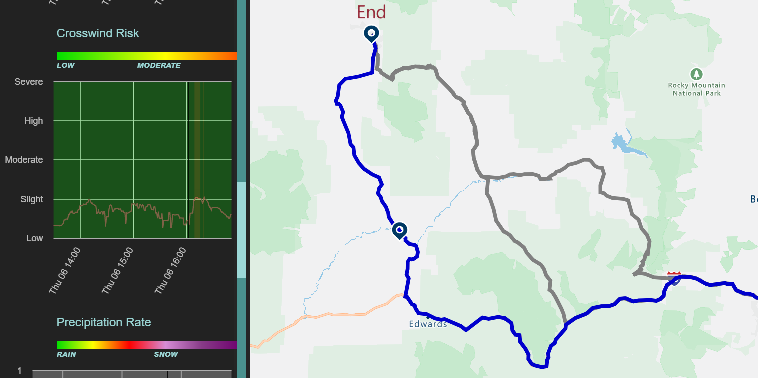
And while there isn’t any precipitation forecasted along the route, there will be some crosswind, which can slow down a driver.

Notice the “Crosswind Risk” graph on the left. The black vertical bar just after 5 p.m. (1600) corresponds to the point on the map between Edwards and “End” or Steamboat.
Wet road use case | Las Cruces, NM to Santa Fe, NM
Here’s how Habistack and Proadject work together when there is precipitation.
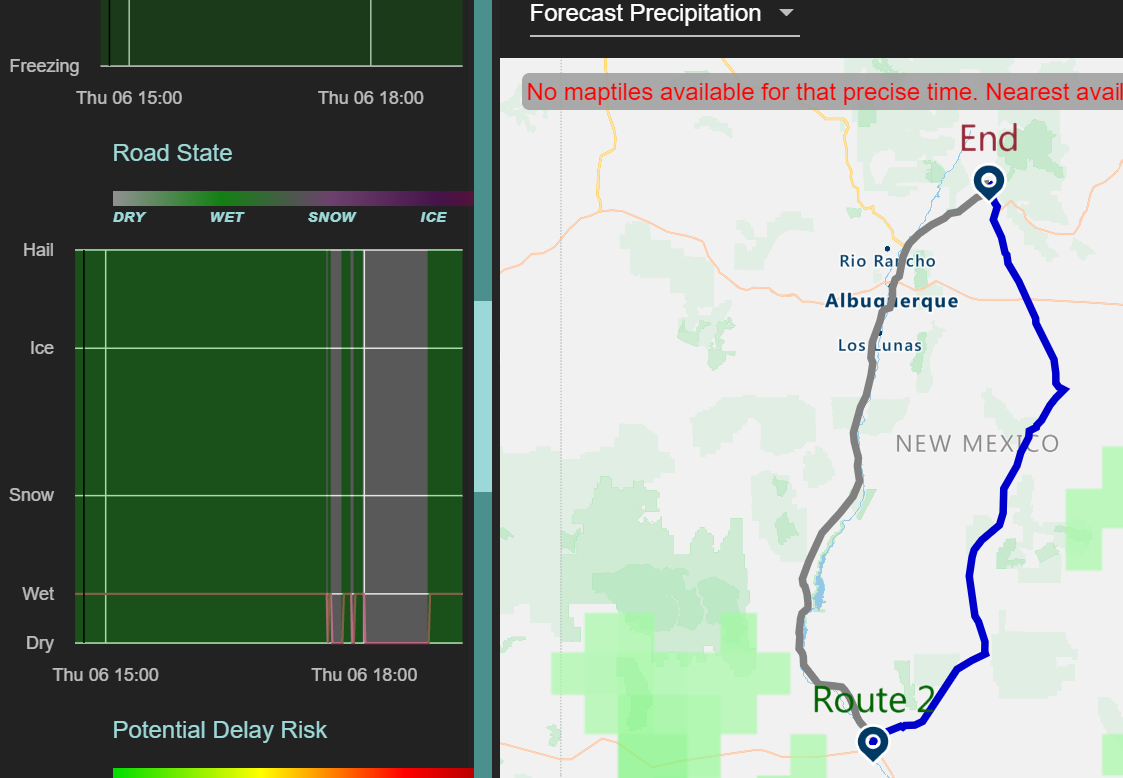
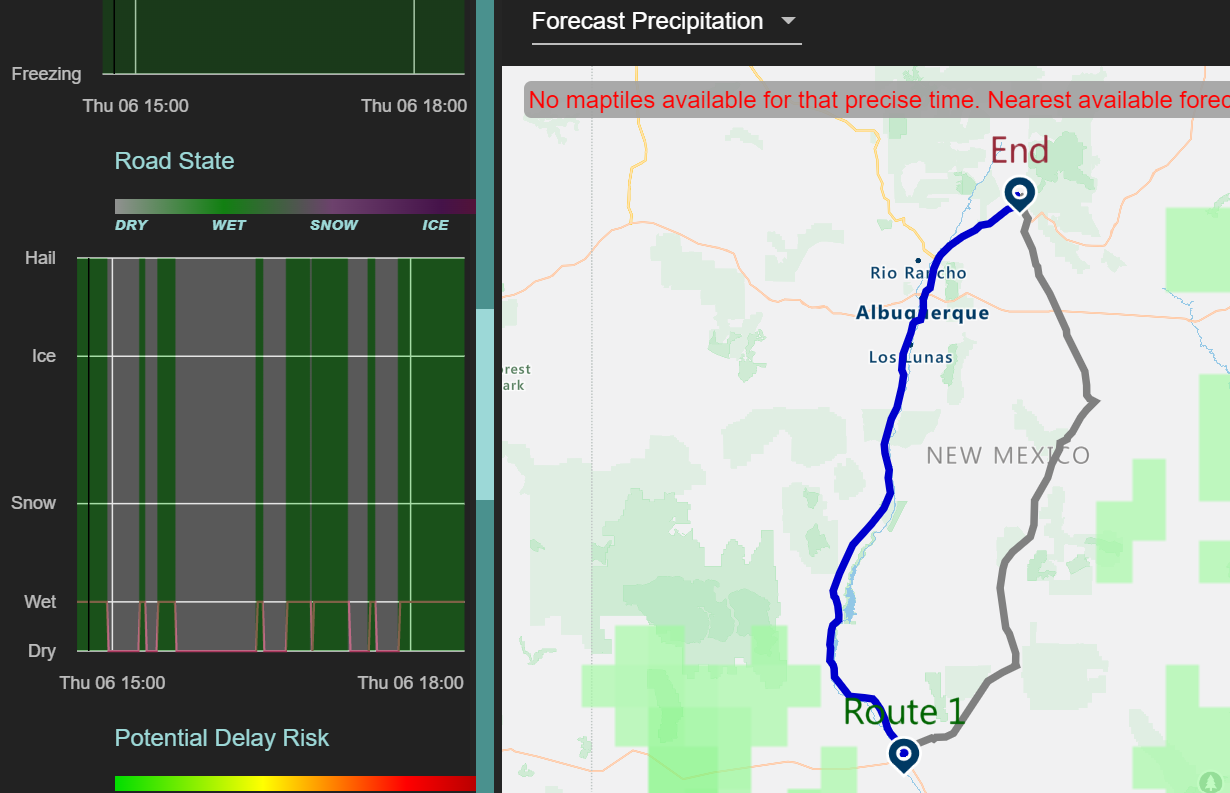
On this first map of Las Cruces to Santa Fe, New Mexico, we see there is expected to be a wet road on three-quarters of the drive on this route on state highway 54.

But by checking the alternate route, I-25, there will only be wet conditions on the road along about one-third of the route.

Driving on wet pavement at highway speeds can get tricky. By using Habistack and Proadject, your travels can be safer, easier and less stressful as you prepare for what’s in your future.
Of course, if you were making a loop and a multi-day road trip, the use of Habistack becomes that much more essential. You’ll want to know the weather and road conditions on your entire journey in that case. Now you can.